Start with a name, not a tiny target
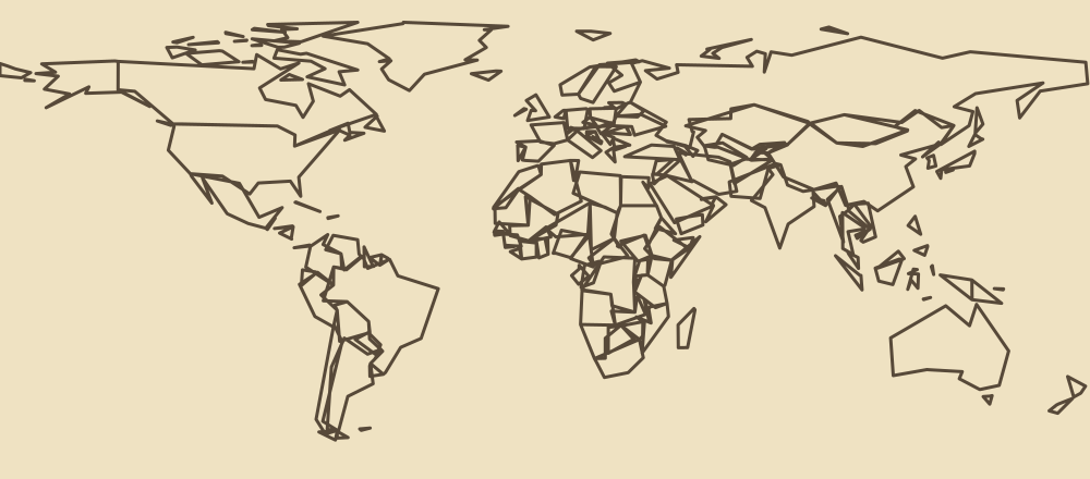
On the Farflung map, a country can be correct and still be hard to see. Search is a useful first move: type the country’s name in the answer field, choose the matching suggestion and check that the selected country is the one you meant. The map can then show its position. A selected country is not submitted until you confirm it, so you can change your mind first.
The Farflung map’s small dots mark some countries whose shapes are hard to see at this scale. They are approximate selection points, not exact borders or capital-city locations. On a phone, search and the zoom controls are often easier than trying to tap a speck.
Worked example: Cyprus in an Asia clue
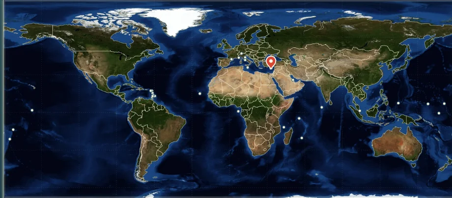
A Farflung practice clue asks for a country in Asia under the UN M49 grouping. Cyprus appears in Western Asia in that grouping and is accepted in the current practice clue. Search for Cyprus, select the result, check the name and then confirm. The practice compares Cyprus with Japan and explains their different fixed point tiers.
This Farflung worked example comes from the practice game, not a promise about the current Daily clue. Regional definitions can differ between sources, so read the clue’s named grouping each time.
Try the worked example yourself
The one-question Farflung Asia practice is a separate exercise: it does not alter your Daily expedition. It uses a country dropdown, while the main game uses the interactive atlas and search. This gives you a quick way to compare answers before returning to the full map.
- Open the Farflung practice page and wait for the country list to load. If it cannot load, use the visible retry button.
- In the Country dropdown, select Cyprus, then press Check answer. In the current Farflung Asia practice, Cyprus is an accepted answer with the Elusive tier, worth 85 km.
- Choose Japan from the same list and check again. Japan is also accepted, with the Common tier worth 40 km.
- Compare the results, then return to the main Farflung game. Search for the country you want and inspect its position on the atlas before confirming.
Both examples satisfy the same region definition; their Farflung distance tiers differ because this site uses fixed editorial levels for each clue. They are not physical distances travelled, estimates of player choices or a prediction of today’s Daily answer.
This Farflung practice is useful even without relying on the picture: the dropdown provides a text alternative, the feedback identifies the outcome, and the game explains the scoring. If the country you expected is not listed, check spelling and the game’s current selector before assuming it is an available answer.
How to use the Farflung atlas without losing your place
- Read the entire Farflung clue. Make sure a candidate meets the region and every extra condition before spending time locating it.
- Use a region shortcut. Europe, Africa, Asia, Americas and Oceania move the view toward a broader area; World returns to the wider view.
- Zoom in. The plus button enlarges a crowded area. Use the minus button to regain context and drag to reposition the Farflung map.
- Search when in doubt. The Farflung answer field can locate a country by name; check the displayed selection before pressing confirm.
- Review after the question. Farflung feedback identifies accepted answers, while the final journal lets you revisit your choices.
If a touch on the Farflung map selects a neighbouring country, select again before confirming. Avoid guessing from a point alone: a country can consist of several islands, and the dot is only a convenient map target.
Practice with three different map problems
| Problem | Example | Useful approach |
|---|---|---|
| A small country in a crowded region | Liechtenstein in a Western Europe clue | Use Europe and zoom, or search its name. |
| An island in the Mediterranean | Malta in a Southern Europe clue | Search to select it instead of tapping at world scale. |
| A country spread over islands | Maldives in a Southern Asia clue | Use Asia and search; the point is approximate. |
Each example fits the stated UN M49 subregion in the current question bank. This Farflung map-reading exercise is not a recommendation that any one answer will always earn the highest score. The rarity tier belongs to a particular clue.
Three more ways to practise a precise selection
Western Europe: the current Farflung Western Europe question accepts both France and Liechtenstein. France is easier to pick by eye; Liechtenstein is much smaller on the same view. Try searching for Liechtenstein, inspect its selection, and compare the answer after confirmation. For this specific clue, France is in the Common tier for 40 km and Liechtenstein is in the Farflung tier for 100 km. These are values from the current question data on this site, not a general rule that small countries always score more.
Southern Europe: Malta is an island that can be hard to select without zooming. In the current Farflung Southern Europe clue, Malta is accepted in the Rare tier for 70 km; Italy is Common for 40 km. Find Malta with the answer field, check the selection label and confirm only after you are satisfied. A region shortcut can help orient the map, but the country name and the clue’s definition remain the checks that matter.
Southern Asia: the Maldives is an island country represented by an approximate point. The current Farflung Southern Asia clue accepts Maldives in the Elusive tier for 85 km and India in the Common tier for 40 km. Because the Maldives consists of many islands, one point cannot show every part of its geography. Use the point as a selection aid, not as a complete geographic outline.
These Farflung examples refer to different questions in this site's current bank. The Daily is selected from that bank and may show different clues; use Practice for additional rounds without disturbing your Daily session. A full-game question is confirmed once, so compare alternatives in its feedback or final journal rather than expecting to resubmit that same question.
What to check when a Farflung selection looks wrong
If a Farflung map tap lands on a neighbour, do not confirm immediately. Zoom in, select again or use the answer field, then read the country name displayed by the game. You can replace an unconfirmed selection. If you are looking at an unfamiliar dot, search for the name first instead of assuming the dot’s position represents an entire island chain.
Make sure the Farflung question asks for the region you have in mind. The UN M49 system distinguishes a broad region from its smaller subregions, and the same country may fit one wording but not another. If a clue names a list, follow the membership of that list; an attractive map position alone does not prove that an answer qualifies. The regional guide explains these distinctions with examples.
If the standalone Farflung practice page cannot load its country list, use its retry option. Its worked answers remain readable without JavaScript, but checking a different country requires the interactive exercise to load. In the full game, keep the selected country visible long enough to verify its name before confirming; after confirmation, read the feedback before moving to the next question.
Separate the geography from the answer rules
Some Farflung clues use a named country list in addition to a region. An island on the map is not automatically eligible for every island-related clue, and a country’s small area does not guarantee it is accepted. For a list-based clue, check the actual condition and source. If the game’s feedback differs from your expectation, read the explanation and linked evidence before applying the same assumption to another question.
For more examples, see the country regions guide or the landlocked country guide. The scoring guide explains why Farflung’s fixed tiers should not be interpreted as live popularity statistics.
Sources and scope
Country examples are checked against the Farflung question bank and the UN M49 geographic grouping. The map uses NASA Earth Observatory imagery and Natural Earth boundaries; supplemental small-country points use Natural Earth data and are approximate. See the map attribution. Names and rules may change, so the live game and the source cited in each clue remain the relevant references.