From first clue to final result
- Choose Daily or Practice. Choose Daily expedition for the set assigned to your device’s date or Practice to play a separate set. Start from the world map.
- Read the whole clue. A clue may ask for a region, a border or another fact. More than one country can fit. Use the convention named in the clue when regional definitions differ.
- Choose a country and check its name. Tap a shape on the map, or type a country’s name and select it from the search results. You can change your choice until you press Confirm pin.
- Review the answer. The game shows why your answer fits or misses. Open Review answer distances to see how other valid choices score. Press Next question to continue. On the fifth clue, choose See my result.
- Read your expedition journal. After the fifth clue, open Compare valid answers on any stop to see the countries that fit and how far each would take you. Find an answer on the map and return to the same journal entry.
When a clue mentions M49, it uses the regional groupings published by the UN Statistics Division.
Three real clues, worked through
These examples use Farflung.lol’s own question pool. They are worked examples, not a prediction of another site’s daily answers.
Example 1: an Asian country and a small island
The clue asks for a country in Asia using the UN M49 grouping. Cyprus fits because M49 places it in Western Asia; Japan also fits in Eastern Asia. On this particular clue, Cyprus earns 85 km and Japan 40 km. Search for Cyprus if its map outline is difficult to tap, confirm your pin, then open the answer comparison to see the other valid choices.
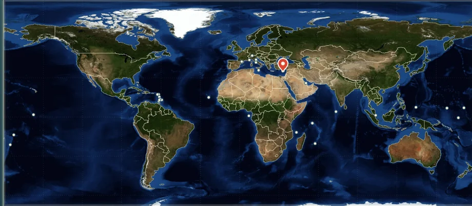
Try this Asia clue and compare its answers · Check the UN M49 regional classification
Example 2: use both parts of a clue
Another practice clue asks for a South American country whose displayed English name begins with B. Bolivia and Brazil both satisfy the region and the initial; a country starting with B elsewhere does not. Find South America on the map or use country search, select one of the two, and confirm. Read the feedback before moving on: the game scores the chosen answer using the tier assigned to this specific clue.
Example 3: find Palau without a tiny tap
In a tested Micronesia clue, searching for Palau, choosing the matching result and confirming returned Correct · Rare · 70 km. The pin uses an approximate location marker. Open the answer distances to see the other accepted countries; the result is specific to this clue and is not a claim about live player choices.
For more map-reading examples, see landlocked countries and finding small countries.
How to read a geography clue
Start by separating the clue into its conditions. A regional clue and a name clue ask different questions: first establish whether the country belongs to the specified region, then check any extra condition such as its initial letter. A country must satisfy both.
Regional definitions are tools, not universal borders
Continental groupings can vary by purpose. For clues using UN M49, the relevant statistical grouping is the rule used by this game. For example, the UN lists Cyprus under Western Asia. A different atlas or cultural discussion may use a different convention; check the wording before deciding that an answer is wrong.
What the map can and cannot tell you
Find the approximate region first, then use the country search when a small island or boundary is difficult to select. This map uses Natural Earth boundary data; it is a small-scale reference map, so a tiny shape or a location marker should not be treated as a precise border survey.
Learn from the answer comparison
After confirming a pin, compare the other accepted answers. The distances on Farflung.lol are assigned to answers in its own clues; they are game points expressed in kilometres, not measurements of the route you travelled or a live count of other players’ answers. See how the scoring works.
Map controls for phone and keyboard
| What you want to do | On a phone | With a keyboard |
|---|---|---|
| Find a region | Tap a region below the map. Use World for the full map. | Use Tab to reach a region button and press Enter. |
| Move around the map | Use the zoom buttons, then drag to pan. At world scale, a vertical swipe scrolls the page. | With the map focused, press + or − to zoom, the arrow keys to pan after zooming, and Home to reset. |
| Choose a small country | Type its name in country search and tap the matching result. Timor Leste matches Timor-Leste, and Cote d'Ivoire matches Côte d’Ivoire. See the UN country names. | Type in country search. Press Enter for a unique exact match, or highlight a result with ↑ or ↓ first. Use Confirm pin to score the selection. Press Esc to close the results. |
Turn on Country names to orient yourself. A small island or microstate may be easier to find by name than by tapping its outline. The map can show a location marker when an outline is too small to use.
How to review an answer on the map
After five clues, open one stop in your expedition journal and select Compare valid answers. Choose View on map next to a country to see its location. Small countries can show an approximate marker. Select Back to answer review to return to that country’s row with the comparison still open.
Use the distance beside each country to compare it with your pin. You can explore as many locations as you like after the round. When you’re ready to share, Copy expedition result shares the score without revealing your answers.
Ready to try a clue?
One accurate country is enough. Once you’re sure it fits, compare alternatives after confirming to see why another valid answer might earn more distance.